On September 8, 2026, the City of Rancho Palos Verdes closed the Palos Verdes Nature Preserve and Abalone Cove Park because of rain, warning that trails could stay closed for up to 48 hours after the last rainfall. The next day, Wednesday, September 9, the city announced that the Preserve was open again, with the usual caveat that some temporary trail closures could remain. With the rainy season about to start, that cycle will come around again.
The closure notice covered the Preserve and Abalone Cove Park. It did not cover the trails along Hawthorne Boulevard, the canyon paths in Miraleste, or the bluff-top walks at Terranea. Those trails make up most of the city's network, and the draft Trails Network Plan released this fall is the first document in decades to count them all in one place.
Forty-Two Miles Outside the Preserve
The draft, marked "Updated Fall 2026," brings together planning that has been spread across separate documents since the 1980s: the original Trails Network Plan of 1984, a Conceptual Trails Plan adopted in 1993, a Conceptual Bikeways Plan revised in 1996, and the Preserve Public Use Master Plan of 2013. Patch reported that the overall plan has not had a comprehensive update since the mid-1990s.
The draft splits the 73-mile network into four systems:
| Trail system | Miles | What it covers |
|---|---|---|
| Arterial | 28 | Sidewalks, decomposed granite and dirt paths along major roads |
| Palos Verdes Nature Preserve | 31 | Trails inside the city's 15 reserves |
| Miraleste Recreation and Parks District | 3.8 | Canyon trails in the Miraleste neighborhood |
| Neighborhood | 10 | Local paths, including trails at Trump National Golf Club, Terranea Resort, Sol Y Mar and Oceanfront Estates |
The arterial, Miraleste and neighborhood systems add up to about 42 miles, more than the Preserve's 31. Upkeep is split among several groups. The city generally maintains the established public trails. The city and the Palos Verdes Peninsula Land Conservancy share maintenance of the Preserve. Private owners maintain about five miles of public trails inside private developments under agreements with the city.
The Numbers Behind the Familiar Walks
Every trail in the draft has a number. The arterial routes are the 100 series, and many still carry segment names from the 1993 Conceptual Trails Plan. Palos Verdes Drive South alone is divided into seven segments:
- Trail 111, Point Vicente Segment, 0.53 miles
- Trail 112, Marineland Segment, 0.63 miles
- Trail 113, Tarragon Segment, 0.6 miles
- Trail 114, Wayfarers Segment, 0.96 miles
- Trail 115, Club Segment, 1.04 miles
- Trail 116, Ocean Vista Segment, 1.15 miles
- Trail 117, Shoreline Segment, 0.3 miles
Palos Verdes Drive East follows the same naming pattern. It ends with Trail 122, the 2.27-mile Miraleste Segment, and Trail 123, the 0.25-mile Deadman's Curve Segment. The longest route in the arterial table is Trail 103, the Hawthorne Boulevard Trail. It runs 10.2 miles of concrete sidewalk from Palos Verdes Drive West to the Rolling Hills Estates line, passing Ken Dyda Civic Center, Ryan and Hesse Parks, Los Verdes Golf Course and Agua Amarga Reserve before continuing toward the Promenade on the Peninsula and the Peninsula Library.
Every route in the arterial table is listed as pedestrian use. They are not wilderness trails. Because they follow the roads, the draft treats them as the backbone of how people get around the city on foot. The Palos Verdes Drive West and South trails alone reach five nature reserves, all seven public beaches, seven city parks, the Point Vicente Interpretive Center and Lighthouse, and Golden Cove Shopping Center.
Where the Coast Runs Through Private Land
The city's best-known coastal walk depends heavily on land it does not own. In 2013 the city built its 7.5-mile segment of the California Coastal Trail along its whole coastline, from the Palos Verdes Estates border to the City of Los Angeles. The draft's list of the trails that form that segment includes road segments, Preserve trails such as the Golden Cove and Seascape Trails, and trails inside private developments, such as the Long Point Bluff Top Trail, the Shoreline Access Trail, and the West Portal Trail and Bikeway.
Those private sections exist because of development approvals. Terranea Resort opened in 2009, and as a condition of its permit it recorded public-use easements on about 2 miles of bluff-top trails, which the resort maintains. The golf course that is now Trump National opened in 2000 as Ocean Trails Golf Club, closed in 2004 and reopened under its current owners in 2006. Its permit conditions transferred more than 114 acres of open space to the city, including Ocean Trails Reserve, three parks and more than 5.5 miles of trails, and the course maintains them on the city's behalf.
The same arrangement brings ordinary trail work. Ocean Trails Reserve has 150 acres, 2.6 miles of trails, public parking and three beach access trails. This summer the city announced that Sunrise Trail would close on September 1 for golf-course erosion-control work with heavy machinery. It also announced that East Boundary Trail would be closed on weekdays through September 25 and open on weekends. Both were short maintenance windows that have now passed.
What the Draft Still Lists as Closed
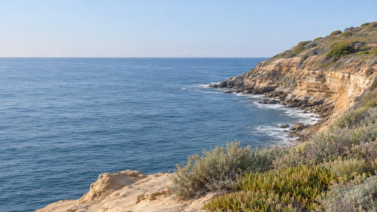
The Preserve is where the network's long-term closures are. It has 15 reserves, and four of them, Three Sisters, Filiorum, Portuguese Bend and Forrestal, form its core: 872 contiguous acres of the 1,500-acre Preserve. When the draft was written, 9 miles of trails in that core were closed because of landslide damage and remediation work. At Abalone Cove, 2.3 miles of reserve trails were closed, along with Abalone Cove and Sacred Cove beaches. Before the damage of 2023 to 2025, the Abalone Cove trails were open to walkers, mountain bikers and, to a limited extent, horseback riders. The draft says some routes may need to be realigned.
For comparison, after the heavy rains of winter 2023 the city closed three public beaches and 12.5 miles of trails affected by the landslide. The draft's figure today is 11.3 miles. The draft presents these closures as current "at the time of writing," not as a live list, and the city's trail conditions page remains the place to check a specific trail.
The ground has slowed. Patch reported on September 16, 2026 that the early-August survey measured average movement of 0.99 inches per week across the areas still moving inside the active landslide boundary, down 9.8 percent from July. In that survey the Portuguese Bend Landslide averaged 0.81 inches per week and the Abalone Cove Landslide averaged 1.29. Patch also reported that the Portuguese Bend slide had slowed 92 percent since before deep dewatering wells were installed two years earlier. No source so far links that slowdown to a date for reopening trails. The draft says the city is working with the City Geologist, the California Coastal Commission and other agencies to assess repairs.
Some core-Preserve trails also have limits that have nothing to do with the landslide. The draft notes that several public trails in these reserves end at private boundaries with the City of Rolling Hills and the Portuguese Bend Community Association, where public access is restricted.
Before the First Storm
The rain rule matters because it applies to the whole Preserve, including reserves far from the landslide. Updates are posted at rpvca.gov/trailalerts, and the Open Space and Trails Division answers questions at 310-491-5775. E-bikes are not allowed in the Preserve, city parks, beaches, or Class I and Class IV bikeways. They are also barred from sidewalks except for riders under 14.
On days when the Preserve is open, the Land Conservancy's reserve guide lists these access points:
- Abalone Cove Reserve at 5970 Palos Verdes Drive South, with paid parking next door, open daily 9 a.m. to 4 p.m.
- Forrestal Reserve from Ladera Linda Community Center, with parking at the center and on Forrestal Drive. The reserve was once part of the Livingston Rock Quarry, which operated from 1945 to 1956, and the old quarry is visible from Canyon Trail, Red Tail Trail and Quarry Trail.
- Portuguese Bend Reserve near Del Cerro Park at the end of Crenshaw Boulevard, with parking on the south side of Crenshaw.
- Filiorum Reserve by McBride Trail at the end of Ocean Terrace Drive, with parking on city and residential streets.
For a flatter walk, the draft describes Vicente Bluffs Reserve as mostly level decomposed granite along the coastal bluff, pedestrian only, with beach access by Tovemore Trail at Pelican Cove Park. Alta Vicente Reserve has 1.7 miles of trails that lead to Hatano Farm, a California Point of Historical Interest, and to Ken Dyda Civic Center.
The Unbuilt Eastern Loop
The draft also shows what is still missing from the network. The Palos Verdes Loop Trail was planned as a 26-mile loop through Rancho Palos Verdes, Palos Verdes Estates and Rolling Hills Estates, and 13 miles of it fall inside RPV, marked with their own signs. Most of the western segments are built. Several eastern segments are still conceptual and are being pursued as development opportunities arise.
The city calls the plan an advisory guide, not a construction schedule. Any conceptual trail would depend on land availability, terrain, natural resources, funding and maintenance costs, and could require environmental review, easements and permits. The effort began in 2012. Six workshops were held between 2014 and 2016, and consultant Alta Planning and Design joined in 2020. Staff now plan to finish the update in 2026.
The draft is still open to change. Workshops took place on September 10 at Hesse Park and September 24 at Ladera Linda Community Park, and recordings are posted on the city's Trails Network Plan page. Comments go to [email protected], and the project team can be reached at 310-544-5267. No comment deadline has been published.
Trail access, coastal easements and Preserve boundaries are part of the property history of the Peninsula, and they come up in real transactions more often than most people expect. If you would like to talk through how the trail network relates to a particular street or property in Rancho Palos Verdes, Jane Angel is glad to help. Book an Appointment.
This article is general information, not legal, tax or financial advice. Consult a qualified professional about your situation.